Autumn · Nov 1, 2026
Bukhansan fall foliage: an easy walk from Hwagyesa Temple (화계사) to the Cloud Observatory
Bukhansan (북한산), the rocky mountain on the northern edge of Seoul (서울), is at its autumn peak, and you can get there on the subway. Korea's weather agency recorded the peak on October 26, two days earlier than its average date, and as of October 31 it still lists the mountain at peak.
Two things to know before you go. This year the colors are paler than usual in places and the leaves are falling early, after an autumn of frequent rain and cold spells. And the weather is about to push things along: rain on Sunday, clearing on Monday morning, then a cold snap on Tuesday and another from Friday. Don't wait for the weekend. Go on a weekday, as early in the week as you can.
You don't need to climb a peak to see it. The Bukhansan Dulle-gil (북한산둘레길) is a walking trail that loops around the foot of the mountain, and its Section 3, Heuin-gureum-gil (흰구름길, "White Cloud Trail"), is an easy way in.
The walk: Heuin-gureum-gil (흰구름길)
The trail runs through oak woods along the foot of the mountain: Mongolian oak (신갈나무, Quercus mongolica), jolcham oak (졸참나무, Quercus serrata) and tteokgal oak (떡갈나무, Quercus dentata), with East Asian alder (오리나무, Alnus japonica) mixed in. Maples (단풍나무, Acer palmatum) give the reds, the oaks turn yellow and rusty brown, and by now the path is soft with fallen leaves. The slopes are gentle and much of the way is on wooden decks. The highlight is the Gureum Jeonmangdae (구름전망대, Cloud Observatory), a 12 m tower with a spiral staircase. From the top you look across Bukhansan's main peaks, Insubong (인수봉) and Baegundae (백운대) among them, then over Dobongsan (도봉산), Suraksan (수락산), Bulamsan (불암산) and the city below. It's the very view the weather agency photographs to track the mountain's color.
There are two ways to do it:
| Option | Route | Distance and time |
|---|---|---|
| Short (recommended) | Hwagyesa (화계사) ↔ Cloud Observatory (구름전망대), out and back | About 0.5 km each way (about 1 km round trip), roughly 15 minutes each way; allow about an hour with the tower |
| Full section | Lee Jun Martyr's Tomb (이준열사묘역) → Bukhansan Ecological Forest (북한산생태숲), via Hwagyesa (화계사) and the observatory | 4.1 km one way, about 2 hours |
The short version gets you the temple and the view with the least walking: the trail signposts put the observatory about 0.5 km from the Hwagyesa entrance, plus the walk up from the station, and you finish where you started, right by the subway. The full section adds the quieter woods on either side and ends somewhere else, so you take a bus back.
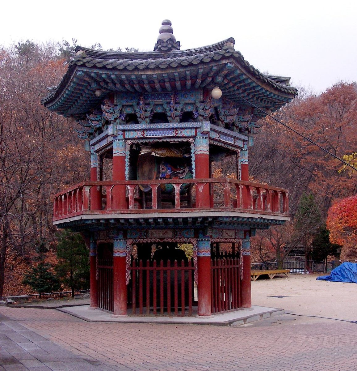
Short version (from Hwagyesa, 화계사):
- Start and finish: Hwagye Station (화계역), Ui-Sinseol Line (우이신설선), Exit 1. Walk up to Hwagyesa (화계사), a working temple, and join the trail there. Naver Map · Google Maps · Temple: Naver Map · Google Maps
- Turnaround: the Cloud Observatory (구름전망대), about 0.5 km along the trail. Take your time at the top, then walk back down the same way. Naver Map · Google Maps
Full section (longer option, Heuin-gureum-gil 흰구름길):
- Start point (들머리): Lee Jun Martyr's Tomb entrance (이준열사묘역 입구). From Suyu Station (수유역), Line 4 (4호선), Exit 4, take village bus Gangbuk 01 (강북01) to the Unification Education Institute stop (통일교육원). Naver Map · Google Maps
- On the way: Hwagyesa (화계사), then the Cloud Observatory (구름전망대), then the Ppallaegol (빨래골) stream.
- End point (날머리): Bukhansan Ecological Forest (북한산생태숲). From the Bukhansan Ecological Forest stop (북한산생태숲), the end of the line, take bus 1014 or 1114 (1014번·1114번) to Gireum Station (길음역), Line 4 (4호선). Naver Map · Google Maps
Tips
- When: a weekday morning, from Monday once the rain has cleared. Earlier in the week is better.
- Alone is easy here. The path stays low, close to the neighborhoods, and there are local walkers on it most of the day, so it feels safe on your own. Bring something warm to drink and take your time at the top.
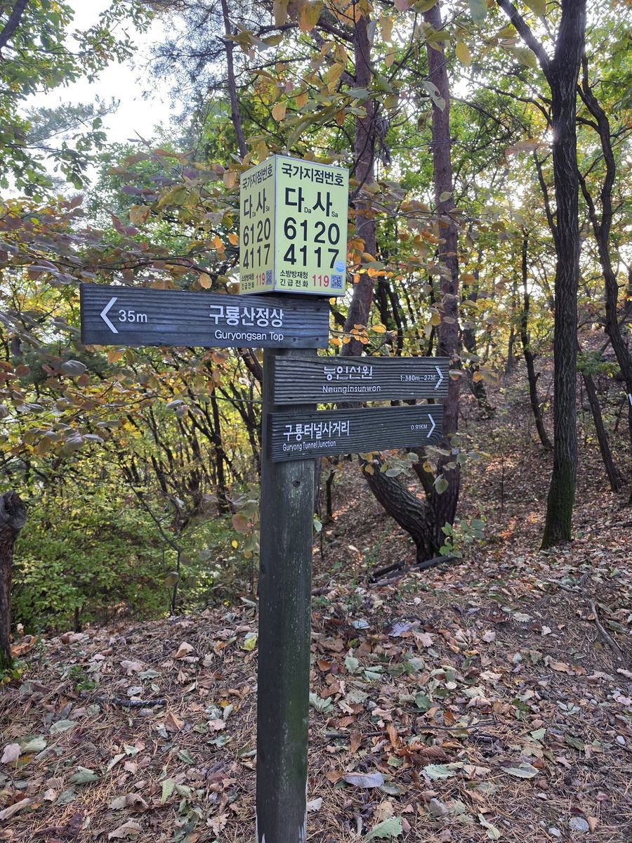
- If you need help: call 119 and say "English"; the operator can bring in an interpreter. Along Korean trails you'll see numbered location posts that pin your spot for rescuers. Read out the numbers on the nearest one, or text 119 a photo of it.
- At the temple: Hwagyesa (화계사) is a working temple, and visitors are welcome. Wander the courtyard, step into the main hall if you like (shoes off at the door), and a quiet nod to anyone you pass goes a long way.
- Dress for cold: Seoul is forecast near 3°C on Tuesday morning, and the top of the tower is open to the wind.
- If the leaves are mostly down, the silver grass (억새) at Haneul Park (하늘공원) stays standing well into November, and you won't need to climb anything to see it.
Coming next
Foliage moves north to south and from high ground to low. The high mountains in the north and east peaked in mid-October, and the color is now in the middle and south of the country. The color starts near the summits and works its way down, so on a tall mountain like Hallasan (한라산) the upper slopes turn well before the foot.
| Place | Summit | Status (Oct 31) | Peak |
|---|---|---|---|
| Gyeryongsan (계룡산), near Daejeon (대전) | 847 m, Cheonhwangbong (천황봉) | At peak | Reached Oct 30 |
| Naejangsan (내장산), Jeongeup (정읍) | 763 m, Sinseonbong (신선봉) | Coming | Forecast around Nov 4 |
| Hallasan (한라산), Jeju (제주) | 1,947 m, summit (정상) | Turning | Forecast around Nov 6 |
| Duryunsan (두륜산), Haenam (해남) | 703 m, Garyeonbong (가련봉) | Turning | Forecast around Nov 11 |
Forecasts move with the weather, so check the mountain foliage status page (Korean, with photos) before a long trip.
Read next
- Silver grass (억새) near Seoul (서울): where to go and how to get there and back
- Quando Vadis: Korea, minus the crowd
All photos © Quando Vadis unless credited otherwise. Please do not reuse without permission.