Autumn · Oct 31, 2026
Silver grass (억새) near Seoul: where to go and how to get there and back
Silver grass (억새, Miscanthus sinensis) is a native grass of dry hills and fields in Korea. It flowers in September and October, and its seed plumes stay standing through the winter. The fields usually look their most silver around mid-October, then turn a soft gold-beige that lasts well into November. Reeds (갈대, Phragmites) look similar but grow in wetlands, on tidal flats and around lakes. Of the places below, the hills have silver grass and Siheung's tidal creek has reeds.
Here are three places you can reach without a car, from easiest to hardest, plus a bonus for a trip to the southeast.
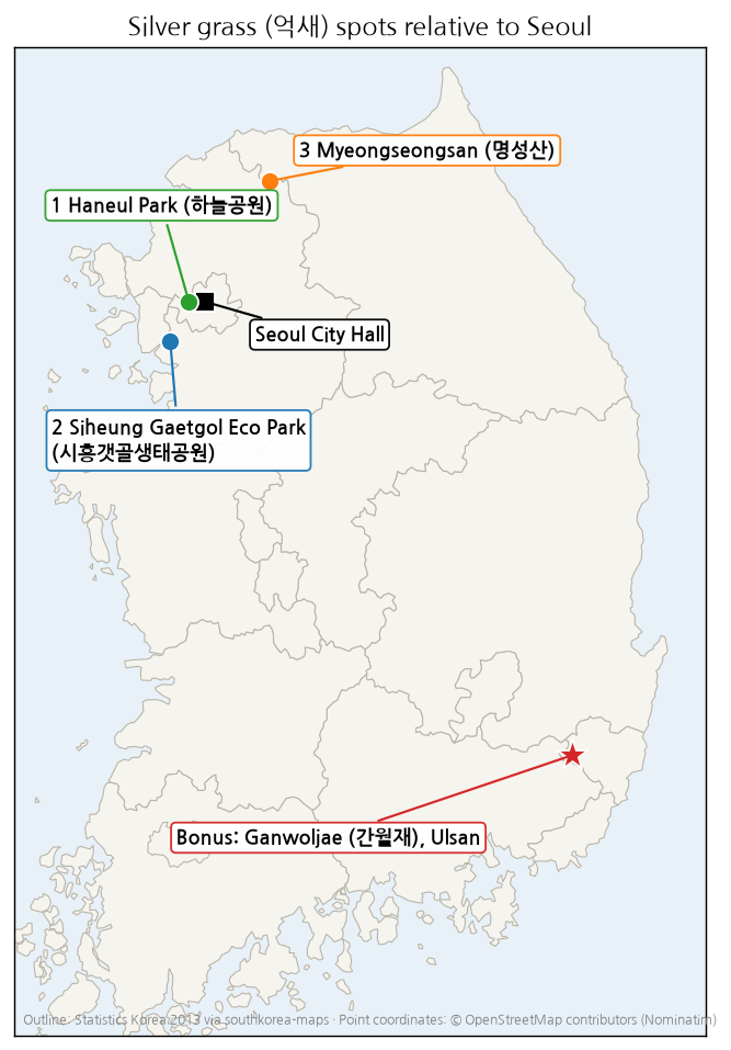
1. Haneul Park (하늘공원), Seoul
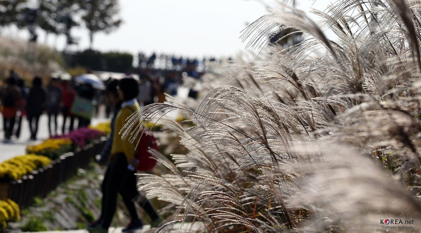
A grassland in World Cup Park (월드컵공원), with views over the Han River, Bukhansan and Namsan. From 1978 to 1993 this was Nanjido (난지도), Seoul's main landfill. Restoration began in 1996, and the park opened in 2002. No hiking is needed. Seoul has postponed cutting the grass until the following spring, leaving it standing for winter birds.
- Start point (들머리): World Cup Stadium Station (월드컵경기장역), Line 6, Exit 1. Naver Map · Google Maps
- End point (날머리): the same station, or Mapo-gu Office Station (마포구청역), Line 6. Naver Map · Google Maps
- Park: Naver Map · Google Maps
- On foot: Allow about 40 minutes from either station to the grass field, including the long wooden staircase (하늘계단). It is short, but your legs will notice it.
- By tram: The Maengkkongi electric tram (맹꽁이 전기차) runs from Nanjicheon Park (난지천공원) to the top. Adults pay 2,000 won one way or 3,000 won return. In October and November it runs 9:00–19:00, every 10–20 minutes; the last ride up leaves 30 minutes before closing. Boarding point: Naver Map · Google Maps
- Hours: From October to December the park is open 6:00–21:00 and closed at night to protect wildlife.
2. Siheung Gaetgol Ecological Park (시흥갯골생태공원), Siheung
A flat park on a winding tidal creek (갯골) southwest of Seoul, where seawater still flows in. Reed beds line the creek, and part of the Siheung tidal flat was designated a national wetland protection area in 2012. A good choice if you want open views without climbing.
- Start point (들머리): Siheung City Hall Station (시흥시청역), Seohae Line. Naver Map · Google Maps
- Getting to the park: The park is about 4 km from the station by road, a short taxi ride of around 10 minutes; book one with Kakao T or k.ride (see below). Walking takes about 45 minutes (about 3.5 km).
- End point (날머리): the park entrance, then back to the station the same way. Naver Map · Google Maps
3. Myeongseongsan (명성산), Pocheon
The best-known silver grass ridge near Seoul, above Sanjeong Lake (산정호수). Its name means "crying mountain": legend has it the birds here wept for a fallen king. These days the only thing crying is your calves. The trail climbs past Biseon Falls (비선폭포) and Deungnyong Falls (등룡폭포) to the field. The ridge is windy even when the lake is calm, so bring a windproof jacket; the grass looks better blowing in the wind than you will.
- Start and end point (들머리·날머리): Sanjeong Lake Sangdong Parking Lot (산정호수 상동주차장), returning by the same trail. Naver Map · Google Maps · Mountain: Naver Map · Google Maps
- By bus: Bus 1386 runs from Dobongsan Station Transfer Center (도봉산역광역환승센터, Lines 1 and 7) to the parking lot about every 40–45 minutes; the ride takes roughly 1 hour 40 minutes, depending on traffic. Naver Map · Google Maps
- By taxi: In October 2026 one hiker got off the bus at Yeongbuk Nonghyup (영북농협), took a Kakao T taxi to the trailhead, and called another after the hike. Another hiker reported about 20 minutes by taxi from Pocheon Bus Terminal (포천터미널). Taxis can be scarce here, so book your return before you are tired and cold.
Taxis: Kakao T and k.ride
Taxis are the easiest way to cover the last few kilometres. k.ride, Kakao Mobility's app for foreign visitors, accepts sign-up by phone number, email or social account and overseas-issued cards; set it up before your trip. Kakao T may also work but needs a Kakao account and may ask for extra verification if you are not Korean. In rural areas, book your return early or keep a local call-taxi number.
Bonus: Ganwoljae (간월재) and Sinbulsan (신불산), Ulsan
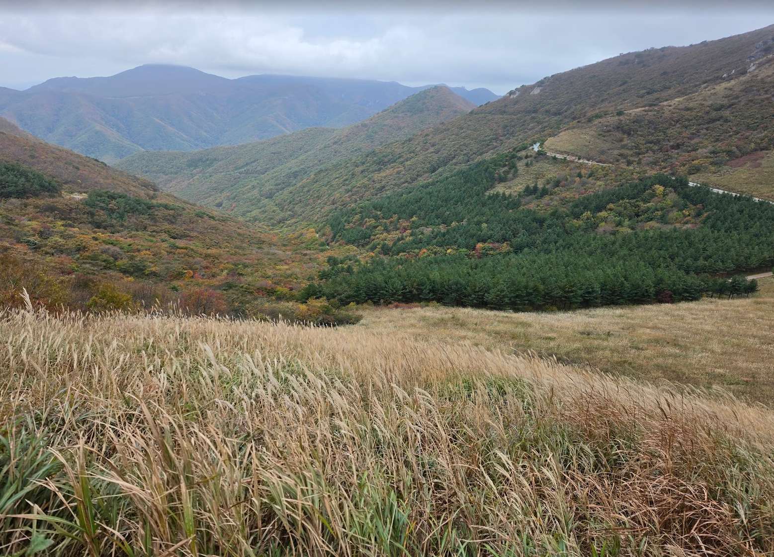
If you are travelling to Busan or Ulsan, Ganwoljae is worth a detour: a pass at about 900 m in the Yeongnam Alps (영남알프스), with a wide silver grass field on the ridge toward Sinbulsan; the silver grass fields of Ganwolsan and Sinbulsan sit at about 1,000 m and above. In 2024 local reports said the field peaked in mid-October and still showed its last silver in early November. Treat it as a trip of its own, not a day out from Seoul.
- Getting there: KTX to Ulsan Station (울산역), then a taxi to the trailhead. Naver Map · Google Maps
- Start point (들머리): Baenaegogae (배내고개). Two hikers in 2026 reported paying about 20,000–22,000 won by taxi from Ulsan Station; expect more in traffic. Naver Map · Google Maps
- End point (날머리): Yeongnam Alps Complex Welcome Center (영남알프스 복합웰컴센터), below Ganwoljae near the Deungeok hot spring area (등억온천단지). One hiker paid about 9,800 won from the Welcome Center back to Ulsan Station in October 2026. Naver Map · Google Maps · Ganwoljae: Naver Map · Google Maps · Sinbulsan: Naver Map · Google Maps
- Getting back: One hiker booked Kakao T after the hike and went straight to Ulsan Station; others said taxis can take a while to arrive. Hikers reported this local call-taxi number: 052-254-4545.
- Start early: on a peak weekend in 2026 the trailhead was already busy at 7:30 a.m.
- Korean hiking culture: Some Korean hikers make this a "no-sleep" trip (무박 산행). They ride a hiking club bus (안내산악회; most clubs just run the bus, with no guide) from Seoul around 11 p.m., start walking at about 3–4 a.m. by headlamp, and are back in Seoul by evening. You do not have to do this. Even with these night buses, Sinbulsan stays far calmer than Seoraksan (설악산) or Naejangsan (내장산), the names most visitors already know. That gap is exactly why we send you here.
Quick comparison
| Place | Getting there | Effort |
|---|---|---|
| Haneul Park (하늘공원) | World Cup Stadium Station (월드컵경기장역), Line 6 | Stairs or tram |
| Siheung Gaetgol Ecological Park (시흥갯골생태공원) | Siheung City Hall Station (시흥시청역) + taxi | Flat walk |
| Myeongseongsan (명성산) | Bus 1386 from Dobongsan Station (도봉산역) | Ridge hike |
| Bonus: Ganwoljae (간월재) | KTX to Ulsan Station (울산역) + taxi | Mountain pass |
Taxi fares are what hikers reported in 2026 and will vary.
All photos © Quando Vadis unless credited otherwise. Please do not reuse without permission.